Reliable assessments of coastal flood hazards require long, spatially consistent records of storm surges, yet tide gauge observations remain unevenly distributed globally, with substantial variations in record length, quality, and completeness. We develop a global deep learning framework for storm surge prediction and reconstruction that leverages both dynamic atmospheric-oceanic forcing and static coastal characteristics.
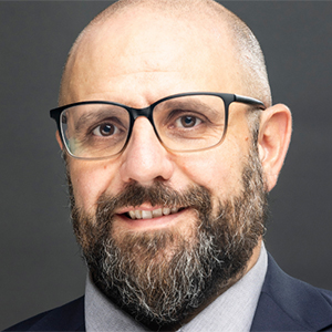
Dr. Thomas Wahl,
UCF
Long Short-Term Memory (LSTM) networks are trained using tide gauge observations from the Global Extreme Sea Level Analysis (GESLA-4) database together with dynamic predictors from the ERA5 reanalysis, including wind speed and mean sea level pressure, as well as hurricane-track information from the IBTrACS dataset. To capture local controls on surge behavior, static predictors such as shelf width, tidal range, and coastal sheltering characteristics are incorporated. Rather than developing site-specific models, the framework learns transferable relationships across diverse coastal environments, enabling predictions at locations with limited or no observations through transfer learning. To further extend applicability to ungauged coastlines, we plan to integrate sparse along-track satellite altimetry observations available since 1992 as an additional source of information. While altimetry provides only intermittent coastal measurements and faces challenges near the shoreline, these observations can constrain and refine local surge estimates where tide gauge records are absent or short. The resulting framework enables the generation of long-term, spatially consistent storm surge records at both gauged and ungauged coastlines, supporting more robust assessments of extreme sea levels, long-term variability, and coastal flood risk worldwide.
Dr. Thomas Wahl is a Professor in the Civil, Environmental, and Construction Engineering Department at UCF and a member the Center for Integrated Coastal Research. He obtained a Diploma in 2007 and PhD in 2012 in Civil Engineering at the University of Siegen, Germany. Afterwards he became a postdoc at the College of Marine Science at the University of South Florida. Before joining UCF in 2017, he was a Marie Curie Fellow of the European Union at the University of Southampton, UK. His research connects coastal engineering and various science disciplines to better understand risks to coastal communities, built infrastructure, and fragile ecosystems. He studies changes in coastal sea levels, ocean waves, and freshwater flows, how they combine to cause coastal flooding and erosion, and how coastal communities can adapt to mitigate the impacts.