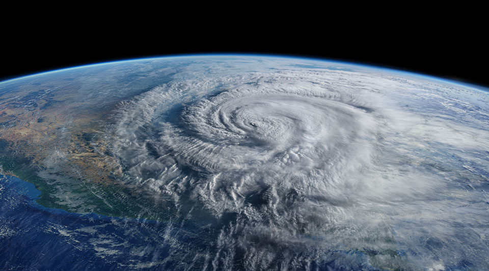
Predicting hurricane intensity has lagged behind tracking its path because the forces driving the storm have been difficult and dangerous to measure—until now.
“When we’re talking 150, 200-mph winds, with 30-foot waves, you don’t send a boat and crew out there to collect data,” said David Richter, associate professor of civil and environmental engineering and earth sciences at the University of Notre Dame.
“We can now send drones and other ‘smart’ oceanographic instruments into hurricanes to take measurements in conditions previously considered too extreme to deploy anything.”

Richter is the lead investigator on a $9-million Office of Naval Research (ONR) Multidisciplinary University Research Initiative (MURI) grant that brings together experts in atmospheric science, oceanography, and physics-informed modeling to improve hurricane intensity forecasts.
Data from the storm’s center will provide crucial insights into the transfer of energy within the hurricane, particularly at the volatile boundary between atmosphere and ocean.

Collaborators on the project include the 53rd Weather Reconnaissance Squadron of the United States Air Force Reserve and NOAA’s Atlantic Oceanographic and Meteorological Laboratory. Their planes, known as “hurricane hunters,” will carry and release some of the team’s autonomous, data-collecting instruments during routine storm missions.
A tube-like device with sensors, a dropsonde, will record a snapshot of wind speed, air pressure, temperature, and humidity on its way from the aircraft to the ocean’s surface. Other air-dropped instruments (profiling floats) will measure water temperature, surface wind and wave height—a key factor in determining surface roughness.
Air-Launched Autonomous Micro-Observer (ALAMO) profiling floats will be used in Richter’s project to collect and transmit data.

Follow Saildrone Explorer SD 1045 as it passes through Sam, a category 4 hurricane.
Saildrones, piloted remotely by NOAA researchers, will navigate into the storm’s center to record such metrics as wind speed, air temperature and humidity, atmospheric pressure, currents and waves. Unmanned aircraft will measure the storm’s low-altitude turbulence.
The collected data will help researchers verify the physical processes dominant in such extreme conditions and develop novel simulation strategies for improving forecasts.
“The goal is always to get better at predicting when and where hurricanes are going to strike and how destructive they’ll be when they land,” said Richter. “The more lead time you have to warn or evacuate people, the better.”
Richter’s research team for this project titled SASCWATCH: Study on Air-Sea Coupling with WAves, Turbulence, and Clouds at High winds, includes researchers from Colorado State, Colorado School of Mines, University of Washington, Woods Hole Oceanographic Institution, Texas A&M University, Mississippi State University, and University of Miami.
— Karla Cruise, Notre Dame Engineering; Photo of David Richter by Wes Evard, Notre Dame Engineering